Housing Society Maps – Lahore
Master Plan Housing Society Maps | Real Estate Maps
Discover detailed housing societies, industrial estates, patwar revenue & cadastral, city & unban master plans, major roads avenues highways motorways & infrastructure, historical & geological maps for Lahore, including master plans, plot layouts & layout plan (LoPs), road networks, and sectors layout & boundaries. Whether you’re a real estate professionals, investors, real estate developer, urban planner, government bodies or buyer, Seerab Maps offer essential insights into approved and developing projects across the city. Updated regularly, each map highlights key zones, accessibility routes, and land-use divisions to support better decision-making.
🔍 Seerab Maps – Pakistan’s Leading Geospatial PropTech Solution for Real Estate, Urban Planning & Development Monitoring
💼 Why Seerab Maps?
✔ Trusted since 2016
✔ P@SHA ICT Award Winner 2018 – Best Innovation in Real Estate
✔ Finalist – UberPitch 2018
✔ Real-time online & on-site plot verification
✔ Reliable geospatial insights for urban development, planning, and investment security
💡 Don’t fall for deceptive property marketing. With Seerab Maps, know exactly where your plot lies, its surroundings, and ongoing development—before you invest.
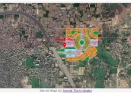
Lahore is a growing hub of modern housing societies and infrastructure. Seerab Maps showcase approved layouts, development status, and planning visuals for both private and public schemes across the district.
 https://www.seerab.com/wp-content/uploads/2022/04/chahar-bagh-lahore-map.jpg
365
976
Author
https://seerab.com/wp-content/uploads/2017/04/Seerab-Logo-Landscape-Website-300x113.png
Author2022-04-16 23:44:132022-06-07 14:48:29Chahar Bagh Lahore Map
https://www.seerab.com/wp-content/uploads/2022/04/chahar-bagh-lahore-map.jpg
365
976
Author
https://seerab.com/wp-content/uploads/2017/04/Seerab-Logo-Landscape-Website-300x113.png
Author2022-04-16 23:44:132022-06-07 14:48:29Chahar Bagh Lahore Map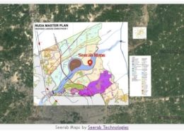 https://www.seerab.com/wp-content/uploads/2022/03/ruda-landuse-zones-phase-1.jpg
365
973
Author
https://seerab.com/wp-content/uploads/2017/04/Seerab-Logo-Landscape-Website-300x113.png
Author2022-03-02 11:49:362022-11-09 16:24:10Ruda Landuse Zones Phase 1 Map
https://www.seerab.com/wp-content/uploads/2022/03/ruda-landuse-zones-phase-1.jpg
365
973
Author
https://seerab.com/wp-content/uploads/2017/04/Seerab-Logo-Landscape-Website-300x113.png
Author2022-03-02 11:49:362022-11-09 16:24:10Ruda Landuse Zones Phase 1 Map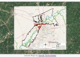 https://www.seerab.com/wp-content/uploads/2022/02/ruda-authority-district-map.jpg
364
973
Author
https://seerab.com/wp-content/uploads/2017/04/Seerab-Logo-Landscape-Website-300x113.png
Author2022-02-05 00:36:042022-11-09 16:58:15RUDA Authority District Map
https://www.seerab.com/wp-content/uploads/2022/02/ruda-authority-district-map.jpg
364
973
Author
https://seerab.com/wp-content/uploads/2017/04/Seerab-Logo-Landscape-Website-300x113.png
Author2022-02-05 00:36:042022-11-09 16:58:15RUDA Authority District Map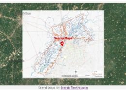 https://www.seerab.com/wp-content/uploads/2022/02/ruda-authority-mouza-map.jpg
367
976
Author
https://seerab.com/wp-content/uploads/2017/04/Seerab-Logo-Landscape-Website-300x113.png
Author2022-02-05 00:32:562022-11-09 17:03:50RUDA Authority Mouza Map
https://www.seerab.com/wp-content/uploads/2022/02/ruda-authority-mouza-map.jpg
367
976
Author
https://seerab.com/wp-content/uploads/2017/04/Seerab-Logo-Landscape-Website-300x113.png
Author2022-02-05 00:32:562022-11-09 17:03:50RUDA Authority Mouza Map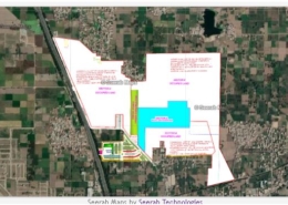 Seerab Technologies
https://www.seerab.com/wp-content/uploads/2020/12/omega-residencia-lahore-map.jpg
365
973
Author
https://seerab.com/wp-content/uploads/2017/04/Seerab-Logo-Landscape-Website-300x113.png
Author2020-12-16 14:31:552022-06-01 12:13:42Omega Residencia Lahore Map
Seerab Technologies
https://www.seerab.com/wp-content/uploads/2020/12/omega-residencia-lahore-map.jpg
365
973
Author
https://seerab.com/wp-content/uploads/2017/04/Seerab-Logo-Landscape-Website-300x113.png
Author2020-12-16 14:31:552022-06-01 12:13:42Omega Residencia Lahore Map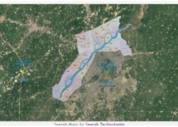 https://www.seerab.com/wp-content/uploads/2020/08/ravi-riverfront-map.jpg
367
973
Author
https://seerab.com/wp-content/uploads/2017/04/Seerab-Logo-Landscape-Website-300x113.png
Author2020-08-12 05:01:552022-06-07 12:45:19Ravi Riverfront Map
https://www.seerab.com/wp-content/uploads/2020/08/ravi-riverfront-map.jpg
367
973
Author
https://seerab.com/wp-content/uploads/2017/04/Seerab-Logo-Landscape-Website-300x113.png
Author2020-08-12 05:01:552022-06-07 12:45:19Ravi Riverfront Map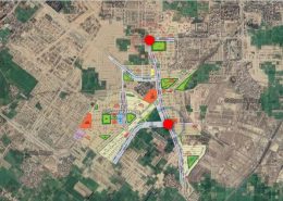 https://www.seerab.com/wp-content/uploads/2020/06/sector-f-bahria-town-lahore.jpg
424
1188
Author
https://seerab.com/wp-content/uploads/2017/04/Seerab-Logo-Landscape-Website-300x113.png
Author2020-06-19 14:30:482022-06-01 12:12:24Sector F Bahria Town Lahore Map
https://www.seerab.com/wp-content/uploads/2020/06/sector-f-bahria-town-lahore.jpg
424
1188
Author
https://seerab.com/wp-content/uploads/2017/04/Seerab-Logo-Landscape-Website-300x113.png
Author2020-06-19 14:30:482022-06-01 12:12:24Sector F Bahria Town Lahore Map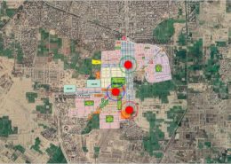 https://www.seerab.com/wp-content/uploads/2020/06/sector-e-bahria-town-lahore.jpg
425
1189
Author
https://seerab.com/wp-content/uploads/2017/04/Seerab-Logo-Landscape-Website-300x113.png
Author2020-06-19 13:35:022022-06-01 12:12:04Sector E Bahria Town Lahore Map
https://www.seerab.com/wp-content/uploads/2020/06/sector-e-bahria-town-lahore.jpg
425
1189
Author
https://seerab.com/wp-content/uploads/2017/04/Seerab-Logo-Landscape-Website-300x113.png
Author2020-06-19 13:35:022022-06-01 12:12:04Sector E Bahria Town Lahore Map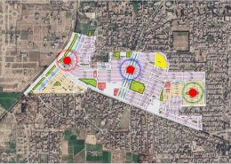 https://www.seerab.com/wp-content/uploads/2020/06/sector-d-bahria-town-lahore.jpg
426
1193
Author
https://seerab.com/wp-content/uploads/2017/04/Seerab-Logo-Landscape-Website-300x113.png
Author2020-06-19 07:00:522022-06-01 12:11:43Sector D Bahria Town Lahore Map
https://www.seerab.com/wp-content/uploads/2020/06/sector-d-bahria-town-lahore.jpg
426
1193
Author
https://seerab.com/wp-content/uploads/2017/04/Seerab-Logo-Landscape-Website-300x113.png
Author2020-06-19 07:00:522022-06-01 12:11:43Sector D Bahria Town Lahore Map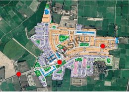 https://www.seerab.com/wp-content/uploads/2020/06/bahria-nasheman.jpg
427
1189
Author
https://seerab.com/wp-content/uploads/2017/04/Seerab-Logo-Landscape-Website-300x113.png
Author2020-06-18 00:01:552022-06-01 12:11:22Bahria Nasheman Map
https://www.seerab.com/wp-content/uploads/2020/06/bahria-nasheman.jpg
427
1189
Author
https://seerab.com/wp-content/uploads/2017/04/Seerab-Logo-Landscape-Website-300x113.png
Author2020-06-18 00:01:552022-06-01 12:11:22Bahria Nasheman Map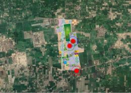 https://www.seerab.com/wp-content/uploads/2020/06/bahria-education-medical-city.jpg
424
1188
Author
https://seerab.com/wp-content/uploads/2017/04/Seerab-Logo-Landscape-Website-300x113.png
Author2020-06-18 00:00:562022-06-01 12:11:02Bahria Education & Medical City Map
https://www.seerab.com/wp-content/uploads/2020/06/bahria-education-medical-city.jpg
424
1188
Author
https://seerab.com/wp-content/uploads/2017/04/Seerab-Logo-Landscape-Website-300x113.png
Author2020-06-18 00:00:562022-06-01 12:11:02Bahria Education & Medical City Map https://www.seerab.com/wp-content/uploads/2020/06/overseas-enclave.jpg
426
1187
Author
https://seerab.com/wp-content/uploads/2017/04/Seerab-Logo-Landscape-Website-300x113.png
Author2020-06-17 16:00:482022-06-01 12:01:34Overseas Enclave Map
https://www.seerab.com/wp-content/uploads/2020/06/overseas-enclave.jpg
426
1187
Author
https://seerab.com/wp-content/uploads/2017/04/Seerab-Logo-Landscape-Website-300x113.png
Author2020-06-17 16:00:482022-06-01 12:01:34Overseas Enclave Map