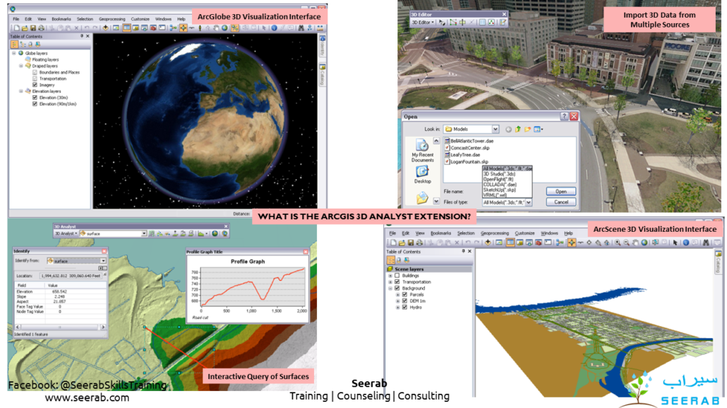
What is the ArcGIS 3D Analyst extension?
What is the ArcGIS 3D Analyst extension?
Three-dimensional visualization and analysis; includes ArcGlobe and ArcScene applications. Also includes terrain data management and geoprocessing tools.
ArcGIS 3D Analyst extends ArcGIS to be a fully functioning 3D GIS system. It allows you to view, manage, analyze, and share your 3D GIS data.
- View huge volumes of 3D GIS data in a global view using ArcGlobe, or view site-level data in a local coordinate system using ArcScene.
- Manage 3D GIS data by editing features directly inside ArcGlobe or ArcScene, and add 3D components to 2D data through geoprocessing tools.
- Analyze GIS data in three dimensions using geoprocessing tools, and use interactive tools in a 3D view.
- Share 3D views of GIS data by publishing Globe Services and share 3D analytic tools through geoprocessing services.


