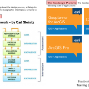
What is ArcGIS Desktop?
ARCGIS DESKTOP
ArcGIS Desktop is the key to realizing the advantage of location awareness. Collect and manage data, create professional maps, perform traditional and advanced spatial analysis, and solve real problems. Make a difference and add tangible value for your organization, your community, and the world.
SOFTWARE
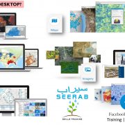
Powerful Desktop GIS—Let professional grade software do your heavy lifting. The two primary desktop applications for GIS professionals are ArcMap and ArcGIS Pro, and both are part of ArcGIS Desktop. Each application has unique capabilities to suit your needs. Create everything from simple web maps to complex analytical models.
MAPS
Create and Design Maps and 3D Scenes—If a picture is worth a thousand words, a relevant map is worth a thousand pictures. Use 2D maps and 3D scenes created on your desktop to visualize data in novel ways and discover non-obvious relationships, inefficiencies, trends and opportunities.
ANALYTICS
Analytics—The world is filled with unanswered questions. Frame these questions, analyze data, get results using an array of analytical tools, and examine your work in 2D and 3D. ArcGIS Desktop includes a rich analytical toolbox and modeling framework that empower you to perform virtually any type of spatial analysis.
DATA MANAGEMENT
Manage Geographic Data—Keep everything under control. Build, manage, and connect geographic information using feature and tabular data, imagery, online maps, 3D data, and much more. Go to the next level and enable enterprise-wide collaboration and manage information collections across your organization via the ArcGIS platform.
IMAGERY
Imagery—Access ready-to-use imagery from the world’s largest, most comprehensive collection. Leverage an intelligent management system that scales to work with petabytes of data and recognizes the sensors that you work with every day.
EXTEND
Extend Your Reach—Get your maps into the hands and onto the smartphones of others quickly and seamlessly. Turn your professional desktop data, maps, and analytics into hosted maps, analysis services, feature layers, and imagery services. Provide managed access for your entire organization using both ArcGIS for Server and ArcGIS Online
3D
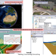
3D GIS—The world is not flat, and you are no longer limited to abstraction. Use 3D to see your data in its true perspective, to make better decisions, and to communicate your ideas more effectively and efficiently. ArcGIS Desktop leads the way in 3D GIS.
Learn everyday one new thing … Stay tuned with Seerab : )

