Best Software to Bridge the Gap between CAD & GIS
Geographic Information Systems (GIS) development is now a norm around the world. Clients like government agencies, municipalities ask all project data in GIS ready file format so they can update their national GIS. Engineering new data is created & existing data is available in Computer Aided Drafting & Designing (CAD) software’s in DWG (Autodesk AutoCAD) or DGN (Bentley Systems MicroStation) file formats. CAD file format can store multiple objects, geometry types etc. point, line, polygon, circle, arc and blocks altogether at in one file. GIS file can store one type of object, geometry in one file and store point, line and polygon separately. CAD to GIS data conversion is big task and now a days in demand skill.
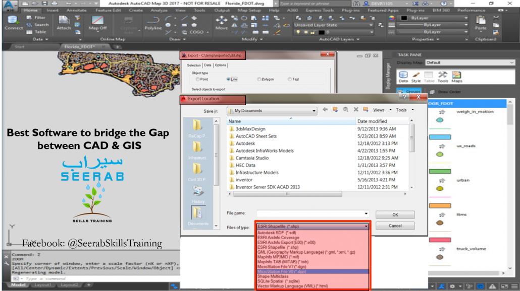
Autodesk product AutoCAD Map 3D is the best software for AutoCAD users to bridge the gap between CAD & GIS. AutoCAD Map 3D has same AutoCAD working environment that AutoCAD user are familiar with. So it easy to learn to AutoCAD users, they just have to learn only AutoCAD Map 3D tools. It has complete set of tools to inspect, edit, modify, convert, export CAD objects, geometry to GIS and vice versa. AutoCAD Map 3D is standalone product, it is built on AutoCAD and has added features of AutoCAD Map 3D. AutoCAD Map 3D is also embedded in AutoCAD Civil 3D (Civil Engineering Building Information Modeling (BIM) software).
Stay tuned with Seerab …. Work Smart by improving YOUR skills


