ArcGIS Pro

What’s new in ArcGIS Pro 1.4?

ARCGIS PRO

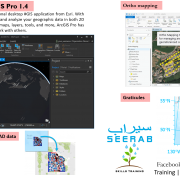
ArcGIS Pro is the premier professional desktop #GIS application from Esri. With ArcGIS Pro, you can visualize, edit, and analyze your geographic data in both 2D and 3D. After you create projects, maps, layers, tools, and more, ArcGIS Pro has several options for sharing your work with others.

ORTHO MAPPING

  • ArcGIS Pro now supports the production of georeferenced ortho products from images from drones, satellites, and digital and scanned aerial photography. These products include georeferenced orthomosaic datasets, georeferenced orthomosaics stored as TIFF or CRF, digital elevation models (DEM), and digital surface models (DSM).
  • You can share a georeferenced orthomosaic dataset as a dynamic image service or cached image service. You can also use the orthomosaic dataset to generate image tiles with the Split Raster tool, or create orthoimage scenes with the Export Mosaic Dataset Items tool.

GEOREFERENCE IMAGERY AND CAD DATA

  • You can now georeference your imagery and CAD data in ArcGIS Pro.
  • Georeferencing imagery defines the locations on the image using map coordinates and assigns the coordinate system of the map frame to the image. Georeferenced images can be viewed, queried, and analyzed with your other geographic data. You can use the georeferencing tools on the Georeference tab to georeference an image.
  • Georeferencing CAD data is the process of spatially adjusting a CAD drawing. After using the georeferencing tools, you can rotate, move, and scale your CAD data, or create control points to perform a transformation.

PORTAL ANALYSIS

  • You can now use ArcGIS Pro to access a number of analysis tools in the ArcGIS platform, including Feature Analysis tools, Raster Analysis tools, and GeoAnalytics tools. When you use these tools, they run on your portal’s federated server instead of on your local desktop machine, and they create new output layers in your portal instead of in a local folder or geodatabase.
  • You can access the tools that are available in your active portal in the Portal group on the Analysis tab on the ribbon, or from the Portal tab in the Geoprocessing pane. To use these tools, you must be connected to Portal for ArcGIS.

GRATICULES

Graticules, which can be used on layouts to show location in geographic coordinates, can now be imported into ArcGIS Pro from your existing ArcMap map documents (.mxd) or inserted from a style. You can customize graticules by rearranging gridlines and ticks and modifying the appearance of labels.

MULTIPATCH EDITING

  • Editing in ArcGIS Pro now includes support for multipatches. In the Create Features pane, you can create multipatch features using the Create 3D Geometry tool Create 3D Geometry, or use the Multipatch tool 3D Models to create multipatch features from 3D models.
  • In the Modify Features pane, you can now use the Vertices tool Edit Vertices to extrude a multipatch feature in a scene. You can drag an existing face; add a new face and drag it outward or inward to create a hole; or create a ridgeline across a face and drag it to create two angular faces, such as those comprising a pitched rooftop. You can also copy a 2D polygon feature to a multipatch layer using Paste Special Paste and extrude it as a multipatch feature.

ARCADE SCRIPTING FOR LABELING AND RENDERING

ArcGIS Pro now supports the Arcade expression language. Arcade expressions are portable throughout the ArcGIS platform. Arcade expressions work in Runtime, ArcGIS Pro, ArcGIS Online, and JavaScript API, while other languages do not. Areas where Arcade expressions are used include labeling, symbology, and range aliases.

Want to learn new things? … Stay tuned with Seerab : )

Pro

Esri

GIS Quote – Roger Tomlinson

“The early days of GIS were very lonely. No-one knew what it meant.”

Roger Tomlinson
Father of GIS

Power BI

What is Power BI?

Power BI is a collection of software services, apps, and connectors that work together to turn your unrelated sources of data into coherent, visually immersive, and interactive insights. Whether your data is a simple Excel spreadsheet, or a collection of cloud-based and on-premises hybrid data warehouses, Power BI lets you easily connect to your data sources, visualize (or discover) what’s important, and share that with anyone or everyone you want.

PARTS OF POWER BI

Power BI consists of a Windows desktop application called Power BI Desktop, an online SaaS (Software as a Service) service called the Power BI service, and mobile Power BI apps available on Windows phones and tablets, as well as for iOS and Android devices.

These three elements – the Desktop, the service, and Mobile – are designed to let people create, share, and consume business insights in the way that serves them, or their role, most effectively.

COMMON FLOW OF POWER BI

The common flow of activity in Power BI is the following:

  • Bring data into Power BI Desktop, and create a report.
  • Publish to the Power BI service, where you create new visualizations or build dashboards
  • Share your dashboards with others, especially people who are on the go
  • View and interact with shared dashboards and reports in Power BI Mobile apps

BUILDING BLOCKS OF POWER BI

The basic building blocks in Power BI are the following:

  • Visualizations
  • Datasets
  • Reports
  • Dashboards
  • Tiles

Microsoft Power BI Desktop is free desktop application … Stay tuned with Seerab  to learn more about BI, Analytics : )

BI

GIS Quote – Jack Dangermond

“The application of GIS is limited only by the imagination of those who use it.”

Jack Dangermond
President of esri

GIS Quote – Waldo Tobler

“Everything is related to everything else, but near things are more related than distant things.”

Waldo Tobler
The First Law of Geography

What is Geodesign?

Geodesign is a new way of thinking about the design process, utilizing site data with software such as a #GIS (Geographic Information System) to create urban or landscape designs.

The Wikipedia’s entry on Geodesign states that “Geodesign is a set of techniques and enabling technologies for planning built and natural environments in an integrated process, including project conceptualization, analysis, design specification, stakeholder participation and collaboration, design creation, simulation, and evaluation (among other stages).“

Michael Flaxman, former MIT Professor and CEO of Geodesign Technologies, states that “GeoDesign is a design and planning method which tightly couples the creation of design proposals with impact simulations informed by geographic contexts.”

The Geodesign Framework: Professor Carl Steinitz, Professor of Landscape Architecture and Planning, Emeritus, brought to the limelight the geodesign framework for landscape architects and designers of the built environment, by posing a series of fundamental questions that as designers of the built environment, should think about and address. Refer to the “Geodesign Framework- by Carl Steinitz” for the summary of questions.

Technology wise, think of CAD, BIM, GIS all in one.
Esri offers a suite of software from 2D mapping to 3D modeling as part of the Geodesign solutions, which combines sketching and modeling tools with the power of data, GIS and high quality renderings. The Geodesign Platform includes mainly the following suite of applications:

Geoplanner for ArcGIS, which is a web-based, easy to use sketching and mapping tool to design scenarios. It leverages geo-based data and supports all the steps of land-based planning and urban design. This includes sketching and designing scenarios (design alternatives), understanding the impact of your designs, perform site and spatial analysis and compare alternative designs.

ArcGIS Pro which is a robust desktop application which render and process data faster than ever. The software allows you to design and edit your concepts in 2D and 3D with multiple view ports. You can perform 3d site analysis like wind analysis, shade/ shadow analysis, circulation patterns, density, view-shed analysis. Designers can add realistic trees, buildings and infrastructures quickly.

CityEngine which is a 3D modeling software which leverages parametric modeling and geo-based data to create evidence-based city and landscape designs. EngineCity creates high quality renderings. CityEngine allows you to import your urban design proposals within existing built urban context in Cityengine. Using parametric and rule procedures, the landscape architect can create, change and test mass modeling to comply with zoning regulations; test shadow area; create detailed streetscapes and create quality public realm spaces. It offers intuitive and effective tools for façade and landscape texturing, adding landscape elements and various tree species. CityEngine provides perspective correction to capture the right views. CityEngine is integrated with ArcGIS. All these tools provide real-time feedback on your changing design concepts.

Geodesign combines site and nature “with design by providing designers with robust tools that support rapid evaluation of design alternatives against the impacts of those designs. Geodesign infuses design with a blend of science- and value-based information to help designers, planners, and stakeholders make better-informed decisions….[the geodesign platform] offers geospatial modeling, impact simulations, and real-time feedback to facilitate holistic designs and smart decisions.”

Want to learn new things? … Stay tuned with Seerab : )

Esri Geodatabase is better then Shape Files

A geodatabase is an alternate way to store #GIS information in one large file, which can contain multiple point, polygon, and/or polyline layers. ESRI is pushing the geodatabase idea, because it is a less “messy” way of organizing data than having multiple shapefiles. in multiple folders. Geodatabases allow users to thematically organize their data and store spatial databases, tables, and raster datasets.

There are two types of single user geodatabases: Personal Geodatabase and File Geodatabase.

Personal geodatabases—All datasets are stored within a Microsoft Access data file, which is limited in size to 2 GB.

A personal geodatabase is a Microsoft Access database that can store, query, and manage both spatial and nonspatial data. Because they are stored in Access databases, personal geodatabases have a maximum size of 2 GB. Additionally, only one person at a time can edit data in a personal geodatabase. Personal geodatabases can also contain domains, use subtypes, and participate in checkout/check-in replication and one-way replicas. You create personal geodatabases in #ArcGIS.

File geodatabases—Stored as folders in a file system. Each dataset is held as a file that can scale up to 1 TB in size. The file geodatabase is recommended over personal geodatabases.

A file geodatabase is a collection of files in a folder on disk that can store, query, and manage both spatial and nonspatial data. A file geodatabase can be used simultaneously by several users, but only one user at a time can edit the same data. Therefore, you can have multiple editors accessing a file geodatabase, but they must be editing different data. The default maximum size of datasets in file geodatabases is 1 TB. The maximum size can be increased to 256 TB for large datasets (usually raster). This is controlled by a configuration keyword. File geodatabases can also contain subtypes and domains and participate in checkout/check-in replication and one-way replicas. You create file geodatabases in ArcGIS.

File geodatabases is preferred storage for Esri ArcGIS and have many benefits including:

1 TB of storage limits of each dataset

Better performance capabilities than Personal Geodatabase

Many users can view data inside the File Geodatabase while the geodatabase is being edited by another user

The geodatabase can be compressed which helps reduce the geodatabases’ size on the disk

Data storage decision is very important … choice and pick wisely … Stay tuned with Seerab : )

Most Famous & Used GIS File Format

The ESRI Shapefile (known here as the #ESRI #Shapefile format), stores nontopological geometry and attribute information for the spatial features in a data set.

The Shapefile format is open and popular for data transfer. An initial state format during map and shape digitization output, employed as a middle state format by many programs and publishers, and used for data transfer between GIS applications. Shapefiles can be created by exporting any data source to a shapefile, digitizing shapes directly, using programming software, or writing directly to the shapefile specifications by creating a program.

A shapefile consists minimally of a main file, an index file, and a dBASE table. The shapefile format can support point, line, and area features. Area features are represented as closed loop, double-digitized polygons. Instances of the Shapefile format have often been used as a data exchange format from ESRI formats to non-ESRI applications.

Must have component: Main file (.shp) and index file (.shx). Shape_DBF, dBASE Table for ESRI Shapefile (DBF).

May have component: Optional component files include files with the following extensions: .sbn; .sbx; .atx; .fbn; .fbx; .ain; .aih; .ixs; .mxs; prj; xml; cpg

The cluster of files is typically stored in the same file directory or project workspace, with all component files having the same filename (prefix) and identified by individual file extension (suffixes).

Want to build a career learn everyday one new thing … be partner with Seerab so we can help you building it :)

Best Software to Bridge the Gap between CAD & GIS

Best Software to Bridge the Gap between CAD & GIS

Geographic Information Systems (GIS) development is now a norm around the world. Clients like government agencies, municipalities ask all project data in GIS ready file format so they can update their national GIS. Engineering new data is created & existing data is available in Computer Aided Drafting & Designing (CAD) software’s in DWG (Autodesk AutoCAD) or DGN (Bentley Systems MicroStation) file formats. CAD file format can store multiple objects, geometry types etc. point, line, polygon, circle, arc and blocks altogether at in one file. GIS file can store one type of object, geometry in one file and store point, line and polygon separately. CAD to GIS data conversion is big task and now a days in demand skill.

Autodesk product AutoCAD Map 3D is the best software for AutoCAD users to bridge the gap between CAD & GIS. AutoCAD Map 3D has same AutoCAD working environment that AutoCAD user are familiar with. So it easy to learn to AutoCAD users, they just have to learn only AutoCAD Map 3D tools. It has complete set of tools to inspect, edit, modify, convert, export CAD objects, geometry to GIS and vice versa. AutoCAD Map 3D is standalone product, it is built on AutoCAD and has added features of AutoCAD Map 3D. AutoCAD Map 3D is also embedded in AutoCAD Civil 3D (Civil Engineering Building Information Modeling (BIM) software).

Stay tuned with Seerab …. Work Smart by improving YOUR skills

One Fastest Way to Geo-reference Pdf Maps

One Fastest Way to Geo-reference Pdf Maps

Mostly maps now comes in Adobe Pdf format. It involves intermediate steps to convert & save unreferenced Pdf maps in raster format and also you compromise on resolution of the map to keep raster file size reasonable.

Blue Marble Geographic’s Global Mapper is standalone spatial data management tool. Global Mapper make unreferenced Pdf maps georeferencing fast & easy. Global Mapper can read GeoPdf and Pdf maps directly, you skip intermediate steps to convert & save Pdf in raster format this save time & effort. Global Mapper also have very handy tools to crop, transform coordinates and export in different file formats.

Stay tuned with Seerab …. Work smart