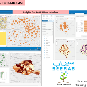
What is Insights for ArcGIS?
Insights for ArcGIS
Insights is an app that allows you to perform iterative and exploratory data analysis. With a drag-and-drop interface, you can answer questions with data from ArcGIS, Excel spreadsheets, and business databases.
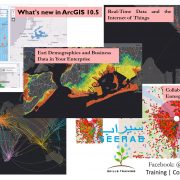
Another notable development in ArcGIS 10.5 is the arrival in ArcGIS Enterprise of a new web application (premium) for exploring spatial and non-spatial data in your organization. Through user-friendly
Fully integrated with the ArcGIS platform, Insights can be accessed from your organization’s ArcGIS portal, allowing you to take advantage of geographic data in your GIS as well as other data sources in the company’s IT system (Excel Files, SQL Database. Explore, analyze, iterate in your layers and tables to reveal trends and phenomena in your data. Although Insights is an application running in a browser, it allows to work on very large datasets in a very efficient way.
In Insights, in a few clicks or by simple drag and drop, the user implements spatial or statistical analysis algorithms sometimes very complex. The multiple viewing options offered in Insights allow you to present your data in maps, diagrams, or tables through forms organized in a multi-page document. These can be saved and shared with other users on your ArcGIS portal. You can also share the workflow of your exploratory analysis to allow other users to replay it on other datasets.
Insights for ArcGIS is a Premium application integrated with ArcGIS Server 10.5.
Key Features
In Insights, you organize your work in workbooks, which can contain multiple pages. An Insights workbook is a new item type in your organization.
With an Insights workbook, you can do the following:
- Integrate data based on geography or common attributes
- Analyze data from multiple sources, such as ArcGIS, Excel, and databases
- Apply spatial analysis tools as a seamless part of your question-and-answer workflow
- Create great-looking maps, charts, and tables using smart visualization defaults
- Enable location for your data with geocoding services, boundary layers from your organization, or custom locations such as sales territories
- Recognize patterns, outliers, and dependencies in your data by interacting directly with maps, charts, and tables
- Automate your analysis with models
- Share your work, data, and results
Learn new things … Stay tuned with Seerab : )
Insights




I find them very useful. Keep doing good work.